 geo.be Metadata Catalog
Environmental monitoring facilities
Type of resources
Available actions
Topics
INSPIRE themes
federalThemes
Keywords
Contact for the resource
Provided by
Years
Formats
Representation types
Update frequencies
status
Service types
Scale
-

INSPIRE compliant download service (WFS) for geographic information of the Marine Spatial Plan made available by the Royal Belgian Institute for Natural Sciences (RBINS).
-

INSPIRE compliant download service (WFS) for geographic information of the Marine Spatial Plan made available by the Royal Belgian Institute for Natural Sciences (RBINS).
-

INSPIRE compliant download service for geographic information of general marine datasets made available by the Royal Belgian Institute for Natural Sciences (RBINS). More specific products such as the Marine Spatial Plan and the MSFD data are provided by other WMS services.
-
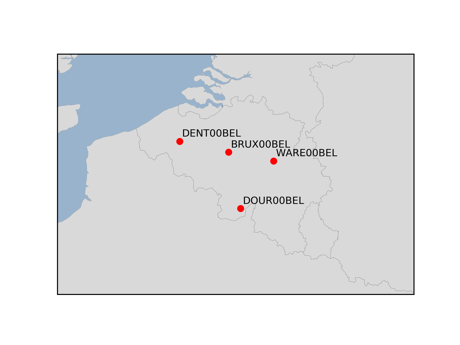
The Royal Observatory of Belgium maintains several continuously observing GNSS tracking stations in Belgium. The stations are also belonging to EUREF Permanent Network (EPN) used to maintain the ETRS89 and the observation data are available to the public through https://doi.org/10.24414/FST8-P256.
-
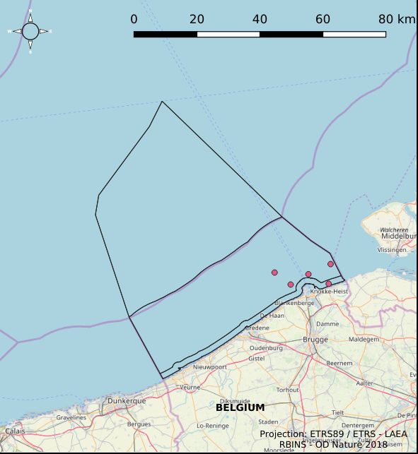
The Royal Decree of 22 May 2019 establishing a marine spatial plan defines 6 measuring poles: Measuring pole MOW.0 (Art. 21§2), Measuring pole MOW.1 (Art. 21§2), Measuring pole MOW.2 (Art. 21§2), Measuring pole MOW.3 (Art. 21§2), Measuring pole MOW.4 (Art. 21§2), Measuring pole Westhinder (Art. 21§2). It replaces the 2014 Marine Spatial Plan, which is included for completeness. The Royal Decree of 20 March 2014 establishing a marine spatial plan defines in its Art. 15. §3, one set of measuring pole locations. These locations are made available digitally in the resource described by this metadata document. Please refer to the Belgian official gazette (\"Moniteur belge/Belgisch Staatsblad\") for official reference information.
-

INSPIRE compliant download service (ATOM) for geographic information of general marine datasets made available by the Royal Belgian Institute for Natural Sciences (RBINS).
-
This dataset describes the location of the samples gathered for the Scientific research program DGL-JW (2021-15) managed bu the FPS Environment. Sampling started in 2004 and lasted until 2021.
-

INSPIRE compliant view service for geographic information of the Marine Spatial Plan made available by the Royal Belgian Institute for Natural Sciences (RBINS).
-
INSPIRE compliant view service for geographic information of the Marine Spatial Plan made available by the Royal Belgian Institute for Natural Sciences (RBINS).
-
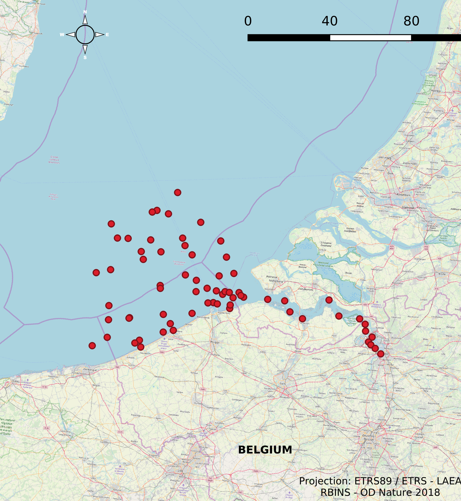
The Scientific Service Management Unit of the Mathematical Model of the North Sea of the Royal Belgian Institute for Natural Sciences has been operating monitoring stations on the Belgian Part of the North Sea since the 1970s. These stations are located in the Scheldt estuary, at open sea and in coastal waters. In 2007, 10 new stations were designated and were placed in the monitoring network needed for the OSPAR convention, the Water Framework Directive and the Marine Strategic Framework Directive. These replaced a series of 54 previous monitoring stations whose data was gathered throughout the years for the Belgian Monitoring Programme and reported according to the recommendations of the OSPAR Convention. This dataset contains information on all monitoring stations ever used by the Scientific Service Management Unit of the Mathematical Model of the North Sea. The dataset provides location, name, operational history and for which reporting obligations they are used.